

Garmin BlueChart® g2 Vision® HD - VUS511L - Boston - Norfolk - microSD™/SD™
Product details
| Management number | 215119722 | Release Date | 2026/04/12 | List Price | $154.54 | Model Number | 215119722 | ||
|---|---|---|---|---|---|---|---|---|---|
| Category | |||||||||
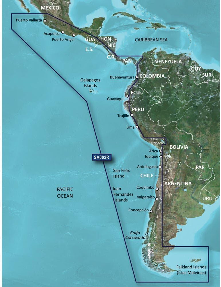
BlueChart® g3 Vision® HD - VUS511L - Boston - Norfolk - microSD™/SD™Coverage:Detailed coverage from Gloucester, MA to Wildwood, NJ., including Cape Cod, Martha's Vineyard, and Nantucket Island, as well as Long Island Sound, New York Harbor, the Hudson R. to its junction with the Mowhawk R., and Raritan Bay. Also provides bathymetric coverage of offshore features from Georges Basin to Baltimore Canyon, including Georges Bank, the Bear Seamount, and the Hudson and Wilmington Canyons.Premier Coastal Navigation ChartsProvides industry-leading coverage, clarity and detail with updated coastal charts that feature integrated Garmin and Navionics® dataAuto Guidance¹ technology uses your desired depth and overhead clearance to calculate routes and show a suggested path to followHigh-resolution relief shading combines color and shadow to give you an easy-to-interpret, clearer view of bottom structure than contour lines aloneDepth Range Shading provides up to 10 depth ranges, enabling you to view your target depth at a glanceUp to 1’ contours provide a more accurate depiction of the bottom structure for improved fishing charts and navigation in swamps, canals and marinasExperience unparalleled coverage and brilliant detail on the water. BlueChart g3 Vision coastal charts provide industry-leading coverage, clarity and detail with integrated Garmin and Navionics data, Auto Guidance technology and high-resolution relief shading..Auto Guidance TechnologyThe Auto Guidance feature¹ uses your desired depth and overhead clearance to calculate a route and a suggested path to follow.High-resolution Relief Shading FeatureHigh-resolution relief shading combines color and shadow to give you an easy-to-interpret, clearer view of bottom structure than
| UPC | 753759069209 |
|---|---|
| Brand | Garmin |
| Map Types | North America |
| Unit Count | 1.0 Count |
| Item Weight | 1.6 ounces |
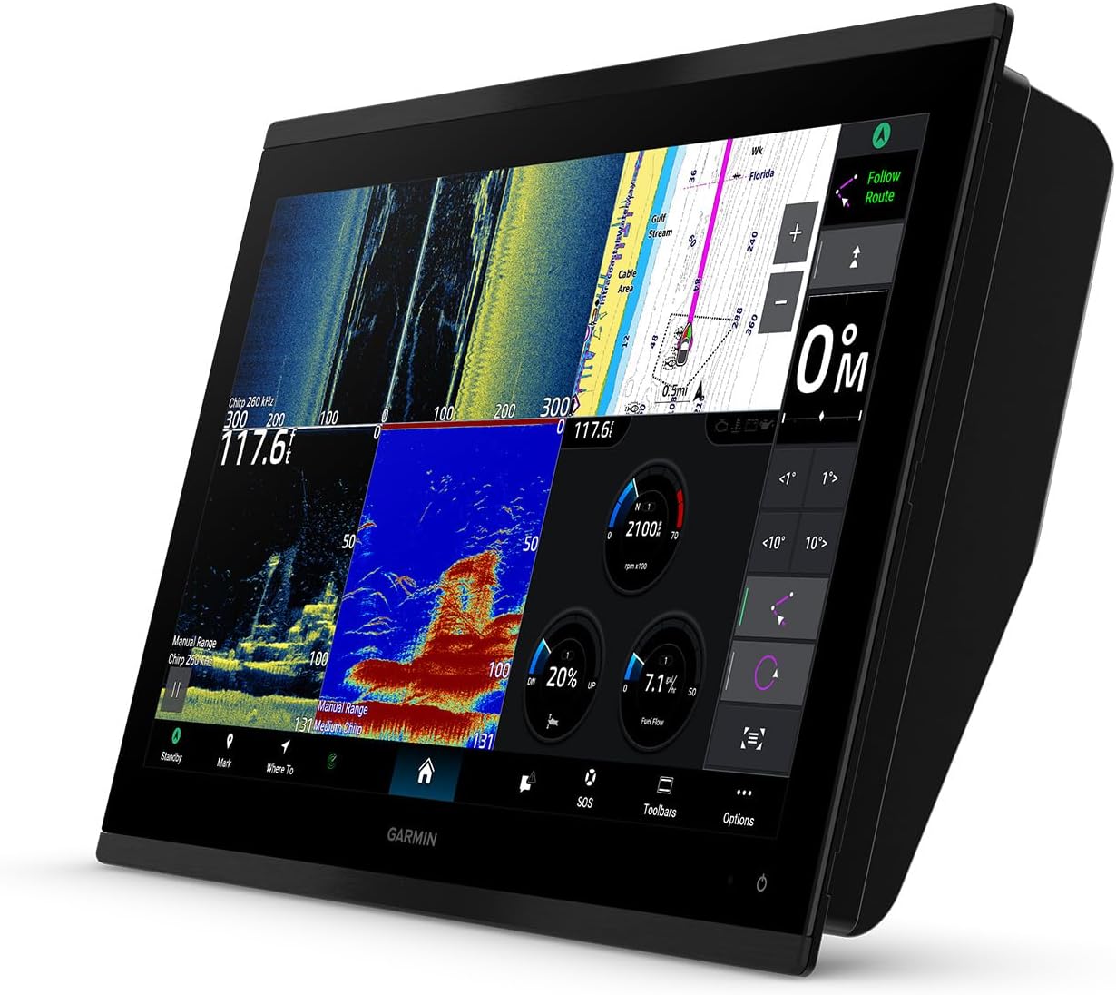
| Screen Size | 9 Meters |
| Display Type | Color Display |
| Manufacturer | Garmin |
| Mounting Type | Dashboard Mount |
| Control Method | Touch |
| Additional Features | Lightweight |
| HumanInterface Input | Buttons |
| Are Batteries Included | No |
| Connectivity Technology | USB |
| Compatible with Vehicle Type | Boat |
| Supported Satellite Navigation System | GPS |
Bestseller ranking
Marine GPS Chartplotters


Correction of product information
If you notice any omissions or errors in the product information on this page, please use the correction request form below.
Correction Request Form